


 (Notice board)
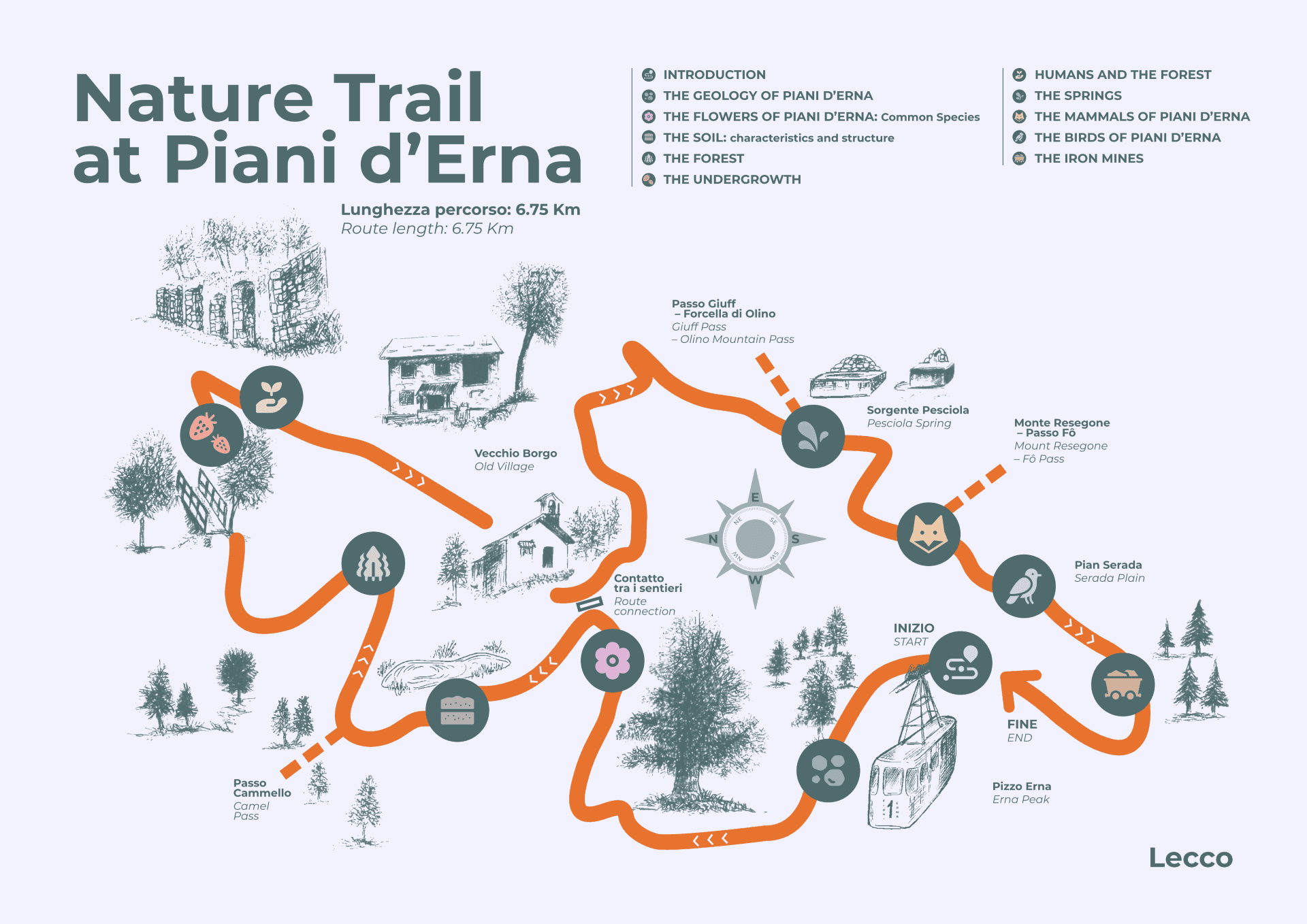
The Piani d’Erna Nature Hiking Trail covers a total distance of about 6.75 km, along which it is possible to encounter several geological, botanical, zoological, anthropological and naturalistic insights. The highest altitude reached by the route is 1,373 metres (Pizzo d’Erna), while the lowest is about 1,160 metres. The small altitude difference (about 215 metres) makes the route accessible to everyone.
12 panels, the most significant ones, out of 21 self-guiding panels present and realised in Italian, were translated into English thanks to the INTERREG Beyond Snow project.
Purpose – The Piani d’Erna Nature Hiking Trail aims to stimulate the curiosity of those who hike along it, emphasising important naturalistic aspects.
Users – The Nature Hiking Trail is accessible to everyone. The graphics in the panels were given priority over the text, as it is more suitable for young people, who will be able to compare the information given with what can be observed along the trail.
Contents – The Piani d’Erna Nature Hiking Trail provides several stimuli for observing the surrounding environment: the panels, distributed along the trail, illustrate the different components that make up a complex system (like that of our Alpine areas), in which geological, biological and environmental phenomena interact, with the presence of human intervention as well.

The geology of Piani d’Erna
(Notice board 2)
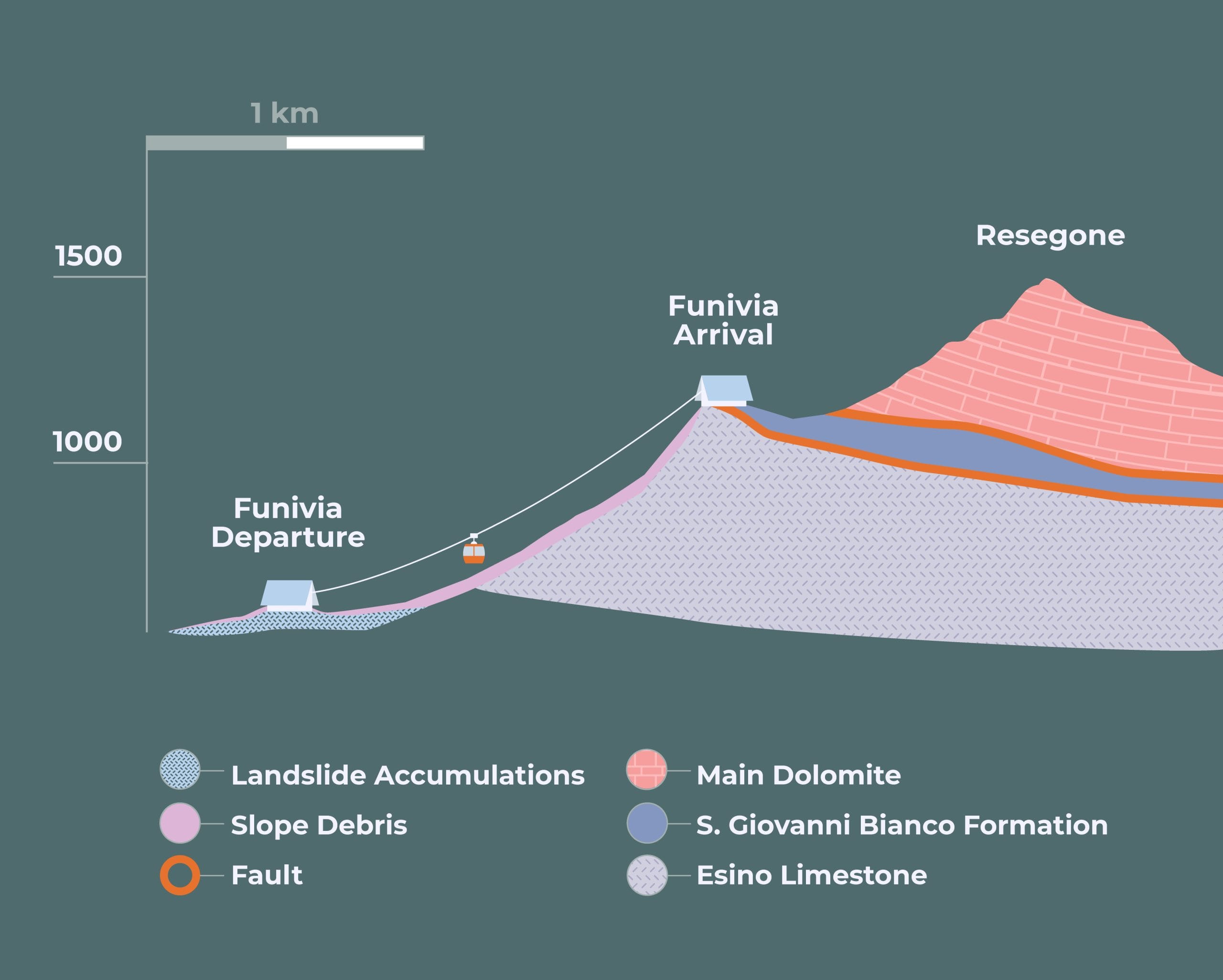
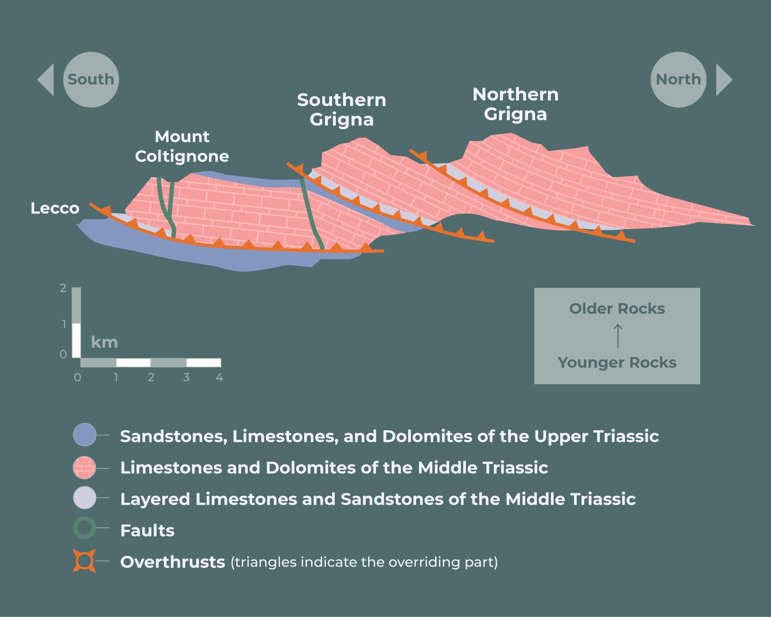
Geology – The development of the landforms is controlled by geological factors and is much less random than one might think. Piani d’Erna constitutes a natural environment that develops at an average altitude of around 1,200-1,350 metres between two steep walls: the western slope of Pizzo d’Erna downstream and the slopes of Resegone upstream. Between these two rocky walls is a much softer type of rock, eroded over time by atmospheric agents (a situation clearly visible in the geological profile on the lower left). The development of the natural terrace was also favoured by the presence of important faults that caused the fracturing of the argillites, making these rocks even more easily eroded
The nature of the rocks of Piani d’Erna – The rocks that make up the Piani d’Erna sector are sedimentary rocks, formed by the accumulation of sediments deposited in ancient seas over 200 million years ago. There are mainly three formations in the Piani d’Erna sector, within which fossils (shells and algae) are locally present, documenting how the original sediments were deposited in a marine environment. The presence of fossils makes it possible to trace back the age of rock formations. In fact, many fossils are typical of a short period in the Earth’s history, and their presence makes it possible to date the rock containing them.

The flowers of Piani d’Erna: the most common species
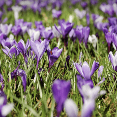
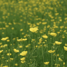
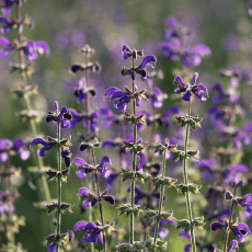
The rich vegetation found on Piani d’Erna includes several species of flowers, some rare, others widespread over much of the Alps and Pre-Alps. The variety of flora and the continuous seasonal changes offer the visitor to Piani d’Erna a landscape that changes colour throughout the year according to the different species.
For each flower, some general information is given such as the flowering period, the growing environment (meadows, forests, rocks), the abundance and whether the species is protected or not. This information is indicative and therefore subject to change. The colour of the flowers may sometimes differ from that depicted in the photographs, because flowers, being living beings, are subject to individual variability. In addition, depending on the climatic characteristics of the year, the flowering seasons may be brought forward or delayed, or sometimes be completely absent.
This panel depicts only the most common flowers that can be found on Piani d’Erna.

The soil: characteristics and structure
 (Notice board 6)
Soil is the substrate indispensable for the development of plant life. In this sense, it represents a natural body consisting of: mineral particles, air, water and organic matter (derived mainly from animal and plant organisms).
What is identified as soil is the result of a long process of chemical, physical and biological alteration that leads to the development of a more or less thick deposit from which plant roots can draw the elements necessary for life and development.
Soil structure – Specialised researchers (called podiatrists) distinguish different types of soils according to several parameters such as chemical nature, alteration status, composition and climate in which they were formed. However, for soils formed on rocks, it is possible to recognise a common general structure (as is the case with Piani d’Erna).
Starting from the top down, in an ideal profile through the soil, it is possible to recognise several main levels:
“0” horizon → the shallowest horizon, characterised by organic matter that is still alive or decaying;
“A” horizon → rich in organic and mineral matter;
“B” horizon → characterised by highly altered and disintegrated rock, reduced to small fragments;
“C” horizon → a portion consisting of altered rock, represented by more or less adjacent rock fragments;
“R” horizon → rock in place, unaltered, forming the substrate from which the soil was formed.
The process of soil formation is very slow and complex, controlled by several factors: at these latitudes it takes hundreds of years for it to develop. The preservation of soils is an indispensable necessity: plants, which extract the necessary nutrients for their development from the soil, form the basis of the food chain. Soils have different characteristics depending on the climate in which they were formed and the rocks from which they generated. The chemical characteristics of soils select the vegetation that can grow there.

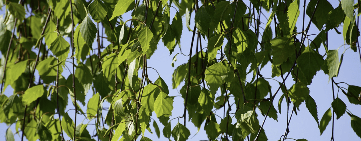
The forest
(Notice board 8)
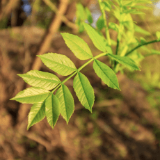
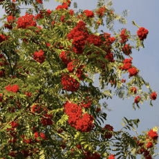
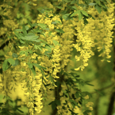
The forests of Piani d’Erna consist mainly of deciduous plants, while evergreens are rare and have been reintroduced in recent years. The most widespread species are beeches and birches, while maples, rowan trees, wild cherry trees, ash trees, laburnums and hornbeams are present in a subordinate manner.
Trees play a fundamental role in human history. Before metals, wood was the main element from which objects for everyday life were made. Trees also have a social significance: they are associated with magical situations or dangers, both real and imaginary (brigands, wolves or monstrous creatures). Individual trees are often given symbolic meanings: think for example of the olive tree (peace) or the cypress (death).
Plant life is closely linked to environmental conditions: climate and soil composition are the factors that mainly control whether a specific tree species can live in a given area. In the Alps, at altitudes above 1,900-2,000 m, trees can hardly survive and the vegetation consists mainly of grasses and shrubs. At altitudes between 1,600-1,700 and 1,900-2,000 metres, conifers, mountain pines, larches and firs can be found. Between 800-900 and 1,600- 1,700 metres (altitude of Piani d’Erna), deciduous plants become abundant along with evergreens. Finally, at altitudes below 800-900 metres, deciduous woods prevail, although Scots pines are still present. The limits between these horizons are often gradual and altitudes may vary from area to area.

The undergrowth
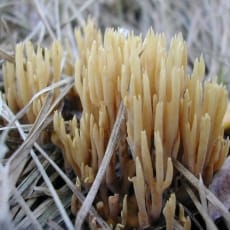
(Notice board 9)
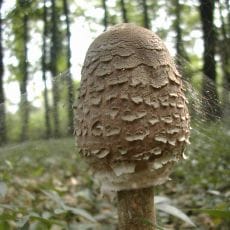
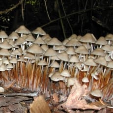
There is a wide variety of other plants in the forest, characterised by their low height and adapted to live in the shade of the leaves of taller plants. The abundance of undergrowth flora can vary from area to area, depending on the sunlight reaching the ground. In the undergrowth, man has found foods, often valuable, to supplement their diet: these are mainly mushrooms and berries.
Mushrooms – Mushrooms are primitive organisms that are most easily encountered during wet periods: on Piani d’Erna, as in all pre-Alpine territories, there are several varieties, both edible and poisonous. Mushrooms play an important role in the environmental balance, favouring the decomposition of organic matter. Their harvesting is regulated by different regulations: in order to engage in this activity, it is essential to be well informed about the regulations, to avoid incurring unpleasant disputes.
Berries – Also, very common in the undergrowth are shrubs that produce fruits and berries. Specifically, berries can be an excellent reproduction vehicle for plants, as they contain the plant’s seeds that are then eaten by animals (excreted in their droppings). In this way, plants secure seed transport over considerable distances. The edible berries of Piani d’Erna include raspberries and wild strawberries, while blueberries are rare.
Ferns: a special type of undergrowth plant – Ferns are also often present in the wetlands of the undergrowth. They are the oldest plants with a complex structure to have conquered dry land: they are the first plants with roots, stem and leaves, but they do not produce flowers, fruit or seeds; in fact, their reproduction is through spores. The latter are released by the plant and germinate to give rise to new small seedlings. This complex reproduction process is typical of primitive plants. Ferns appeared on our planet millions of years before the plants visible in the Piani d’Erna forest. The appearance of more evolved and more competitive organisms later relegated them to a secondary role.

Man and the forest
(Notice board 11)
Of the products obtained from the forest, the main one is wood. Over the centuries, wood has been used for many purposes: heat, tools and charcoal. A curiosity is that, in addition to wood, beech leaves were also harvested to make bedding for farm animals. The forest from which the wood is regularly harvested is called coppice forest.
Forest conservation and management has always been indispensable for people living in mountainous areas. In this photograph, you can see the typical appearance of a forest on Piani d’Erna: it is mainly beech trees.
Man’s use of the forest – Forest products have always been a major resource for the inhabitants of mountain areas. These products are often edible and are the natural habitat of many animal species whose hunting has provided direct nourishment for humans.

The springs
 (Notice board 16)
Diagram of springs origin – The presence of living beings (both animals and plants) in a given territory is closely linked to the availability of water. In the area of Piani d’Erna, the presence of water has allowed the development of dense vegetation and rich pastures. In addition to the Pesciola spring, other springs are widespread along the Nature hiking Trail.
What is a spring? – The distribution of springs in a territory is always controlled by geological factors: the presence of subsoil portions made up of soils or rocks with different permeability is essential for their generation. In fact, springs represent the emergence of groundwater, specifically, rainwater and surface water that infiltrates the subsoil; when they encounter an impermeable level, they can no longer descend to the depths and, if conditions are favourable, they can come to the surface forming springs. These can thus be perennial or periodic. The Pesciola spring is a perennial spring (as it has water all year round) with a limited flow rate.

The mammals of Piani d’Erna
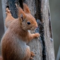
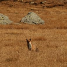
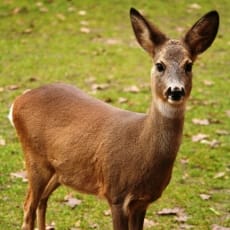
(Notice board 17)
Walking through Piani d’Erna, it is possible to detect the presence of some wild mammals through their tracks. Below is some information on the main mammals that can be encountered along the route or whose presence can be detected through the tracks left by their passage.

The birds of Piani d’Erna
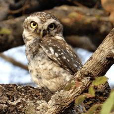
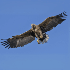
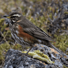
(Notice board 18)
This panel depicts some birds that can be spotted during a walk on Piani d’Erna. In order to observe birds, it is necessary to move warily without making unnecessary noise. The sighting of some species may be casual, while observing the trees or peering at the sky. Another effective method is by listening to the song, which allows the presence of the animal to be detected.

The Iron Mines
(Notice board 19)
In the Piani d’Erna area, there are some concentrations of iron ores, which have been the subject of limited mining activities in the past. The presence of mineralisation in a given area is generally controlled by geological factors. The iron mineralised areas of Piani d’Erna are all located in the area of the ridge towards Lecco (especially in the area of the small church and Pizzo d’Erna).
Between the end of the 18th and the beginning of the 19th century, the search for iron ore and its processing had an impact throughout the Lecco area. The activity of the iron-ore furnaces led to an enormous demand for timber, and thus to major deforestation. The consequences of this senseless intervention led to upsetting the balance that man had created with the mountain territory in previous centuries. The consequence of this activity can still be observed today: conifers have disappeared from Piani d’Erna and larches and spruce firs are sporadic and rare.
The concentration of iron ore is, however, not very abundant and mining activity in Piani d’Erna has never reached significant levels. The earliest records of iron ore extraction date back to the late 18th century, when the increasing demand for this metal by Lombard workshops led to the search for new mineral deposits. The intensification of the search was also favoured by both the support of the Austrian government (which then controlled the area) and the development of new techniques for processing the raw ore.
The quality of iron ore from Piani d’Erna was rather poor. These difficulties made the extraction and processing of iron very unprofitable. As a consequence, mining was stopped a few years later and in the early 19th century the mines were abandoned. Only temporarily, during the following years (until the Great War), were the mines opened or re-investigated, but with very poor results.
Resources area

We would like to thank for their collaboration: Lorenzo Baio, Paolo Colombo, Simona Colombo, Damiano Di Simine, Rebecca Forte, Cinzia Peschechera. For the photographs: Lorenzo Baio, Daniele Colombo, Stefano Gomarasca, Andrea Rutigliano.
The translation of these information boards at Piani d’Erna was carried out by Legambiente Lombardia with the financial support of the Interreg Alpine Space BeyondSnow project.
BeyondSnow is an Interreg – Alpine Space project co-funded by the European Union. It aims at decreasing the snow-dependency of Alpine Space snow tourism destinations, strengthen their resilience to climate change and retain/increase the viability for residents and their attractiveness for tourists.
![]()
![]()